Hedgerows, Pixels and the Paper Trail: A Drone Baseline That Ecologists Can Defend
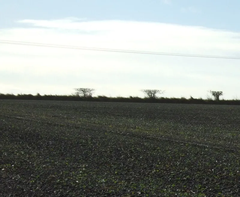
Photo: JThomas , CC BY-SA 2.0, via Wikimedia Commons
Biodiversity Net Gain has turned a lot of UK hedgerows into paperwork. That is not a complaint, just a fact of life for anyone flying surveys on farmland, development sites and country estates in 2026. The ecologist needs a baseline. The planner needs something defensible. The landowner wants you off the gate by lunchtime. A drone can help with all three, but only if the pilot understands where aerial evidence stops and ecological judgement begins.
This is not a guide to identifying species from 80 metres. It is a guide to producing a clean, well-labelled aerial baseline that supports a BNG assessment without pretending a pixel is a plant list.
Start with the question the ecologist is actually asking
Before you open a flight app, ask what the survey is for. A BNG baseline is usually about habitat parcels, hedgerow extent, gaps, tree cover and broad structural condition. The ecologist may want an orthomosaic to digitise UKHab polygons, a DSM to see canopy height, or simply a dated aerial record for a site that is about to change.
Get the deliverable agreed in writing. A useful question is: what will you do with this layer? If the answer is trace hedgerow centre lines and mark gaps, you need sharp, leaf-on imagery and a sensible scale. If the answer is measure canopy height, you need a DSM and a clear note about accuracy. If the answer is identify every shrub species, you need to manage expectations politely and quickly.
A drone survey is evidence, not an ecology report. Say that early and the handover gets easier.
Capture plan for a hedgerow site
Take a mixed 30 to 40 hectare holding in Herefordshire or the Borders. It has boundary hedges, a few overgrown lengths, some recent laying, a couple of gaps, and mature trees dotted along the lines. You want a baseline before a housing allocation or a habitat management plan moves things on.
For hedgerow structure, aim for 2 to 3 cm ground sample distance. A 20 megapixel one-inch sensor at roughly 70 to 90 metres can get you into that range, depending on lens and overlap. For broad habitat extents, 4 to 5 cm is often plenty. Do not fly higher just to save time if the ecologist needs to see gaps and crown edges. The difference between a tidy orthomosaic and a smeared hedge is usually overlap and light, not sensor marketing.
Use 75 to 80 percent forward overlap and 65 to 70 percent side overlap. Fly a nadir grid for the whole site, then add oblique passes along the main hedgerow lines. Hedges are vertical-ish features. A pure top-down flight will give you the top of the canopy and not much of the side structure. Oblique images help the processing software build a more realistic surface, but they can also create leaning artefacts if you push the angle too hard. Keep it moderate and consistent.
Fly leaf-on if the brief is a habitat baseline. Winter imagery can be useful for gaps and boundaries, but it is a different dataset. Record the date, time, sensor, altitude, overlap and weather. Low sun and long shadows make hedgerows look dramatic and GIS layers look awful. Wind is the usual enemy of clean stitching, so leave the flight if the gusts are pushing the hedge about.
Ground control and the boring bits that save the handover
If the output needs to sit against Ordnance Survey mapping or a planning boundary, work in British National Grid, EPSG:27700. Say so in the metadata. If you are using RTK, still think about checkpoints. If you are using ground control points, place them where they will be visible and not buried in a hedge. A handful of well-spread GCPs and a few checkpoints will tell you whether the model is behaving.
Process to an orthomosaic and a DSM. Keep the raw images and the flight log. Export a Cloud Optimised GeoTIFF if the ecologist uses GIS professionally, plus a PDF map for the report. Name files like a grown-up: site name, survey date, product, coordinate system and version. A folder called final_final_2 is not a handover.
What to hand over, and what not to claim
A compact BNG package might include:
- Orthomosaic GeoTIFF in EPSG:27700
- DSM or point cloud if canopy height is relevant
- Flight log and processing report
- Ground control and checkpoint accuracy note
- A simple QA sheet listing date, sensor, GSD, weather and limitations
- Optional draft hedgerow lines or habitat polygons, clearly marked as aerial interpretation
The last item is where pilots get into trouble. You can digitise a hedge line. You can mark an obvious gap. You cannot confidently label every crown as a particular species from an orthomosaic. If you provide draft vectors, label them as draft and let the ecologist validate them on the ground. Use terms like canopy, gap, potential hedgerow and tree crown. Avoid species names unless the ecologist has confirmed them.
The hedgerow gaps and tree crown problem
Hedgerow gaps are not always as simple as they look. A gap in the canopy may be a genuine break, a gateway, a fence line, a recently planted section or a tree that has swallowed the hedge. Tree crowns overhang and cast shadows. Photogrammetry can stitch the top of a crown into the hedge line and make a continuous feature where there is actually a gap underneath. Low oblique imagery helps, but ground truth still matters.
Mark what you can see and note the uncertainty. If a hedge runs under mature trees, do not force a clean centre line through it. Draw the visible sections, flag the obscured length, and let the ecologist decide how to record it. The same goes for scrub encroachment and fence lines. A fence is not a hedgerow, even if it looks like one in a 3 cm orthomosaic.
A compact workflow for a UK holding
Desk study first: check airspace, NOTAMs, landowner permission, weather and site hazards. Plan the grid, add oblique lines along the main hedges, and set the camera. On site, place GCPs if required, capture a few ground reference photos, then fly the grid. Keep the flight log and note any areas you had to skip.
Processing usually takes a couple of hours for a small site. Then spend real time on QA: check the orthomosaic for stitching errors, inspect the hedge lines at full resolution, compare the DSM against known heights, and confirm the coordinate system. Write a short readme. Send a download link with a checksum or at least a clear folder structure. Offer one revision round for labelling or file naming, not a free reflight because the ecologist changed their mind about the whole survey design.
Pricing a compact BNG survey in 2026
For a straightforward 20 to 40 hectare site with around 1.5 to 2 km of hedgerow, a sensible 2026 price is often £550 to £950 for the flight, processing and standard GIS handover. Complex sites, multiple landholdings, RTK ground control, urgent turnaround or lots of draft digitising can push that to £1,200 or more. Travel and data management should be visible in the quote, not buried.
Do not sell it as just photos. You are selling a defensible baseline package: capture, processing, QA, metadata and a handover that an ecologist can drop into their workflow. That is the bit that takes the time.
Before you press send
Check the coordinate system, the date, the GSD and the limitations note. Make sure the draft vectors are labelled as draft. Keep the raw data. And remember the handover is the product. A neat orthomosaic with no context is just a nice picture. A well-labelled, honest aerial baseline is the thing that gets you the next BNG flight.